Soil Survey of Meade and Breckinridge counties complete
The Meade County Messenger, Brandenburg, Kentucky, Wednesday, November 20, 2002
By PAT BOWEN
Messenger Staff
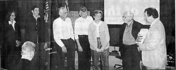
John Bruington, far right, presents the soil conservation survey to the Scott famliy. A
photo of the Scott family farm, which has been in existence for 200 years is featured on
the cover of the survey. Left to right: Frances Scott, Alan Scott, Jess Scott, Ann
Scott Doman, Martha Scott Clift, Jack Scott, John Bruington.
Eighteen years and $400,000 later Meade and Breckinridge
counties have a complete soil survey. The United States Departrnent of Agriculture and the
National Resources Conservation Service, in cooperation with the Kentucky Natural
Resources and Environmental Protection Cabinet and Kentucky Agricultural Experiment
Station were all involved with making this one-inch thick report a reality.
The original agreement to tackle the daunting task was
signed in 1984 with the local soil conservation district board. Major fieldwork, which
encompassed walking every inch of the two counties and taking soil samples was completed
in 1992. In some areas deep pits were dug for in-depth information, and many tests were
done to analyze permeability and other aspects of the soil. Each area is described by type
of soil, slope, and erosion.
Twenty-two percent of Meade County is designated as
"prime farmland" and this survey helps all farmers in the county to maximize
their crop yields. It also assists planners and developers by identifying the permeability
of the soil which affects the sewage treatment system and construction parameters for
building.
Both counties are divided into grids, and each grid has a
corresponding topographical map. After locating a particular area, you can then go through
the index and find descriptives for each soil type in various scenarios. The soil
classification is listed and several paragraphs then describe the characteristics of the
soil, the compositon of the layers, permeability, water capacity, and suitability for
crops, urban, and wildlife uses. Tables give the temperature and precipitation, freeze
dates in spring and fall, growing season, acreage proportionate extent of the soils, land
capability and yields per acre, capability classes and subclasses, woodland management and
productivity, recreational development, wildlife habitat, building site development,
sanitary facilities, construction materials, water management and other aspects of each
soil type.
A wealth of information and invaluable planning reference
for the county, copies are available at the Soil Conservation office on the corner of
Armory Place and Old Ekron Road.